Dalton Highway, Fairbanks to Prudhoe Bay (Arctic Circle)
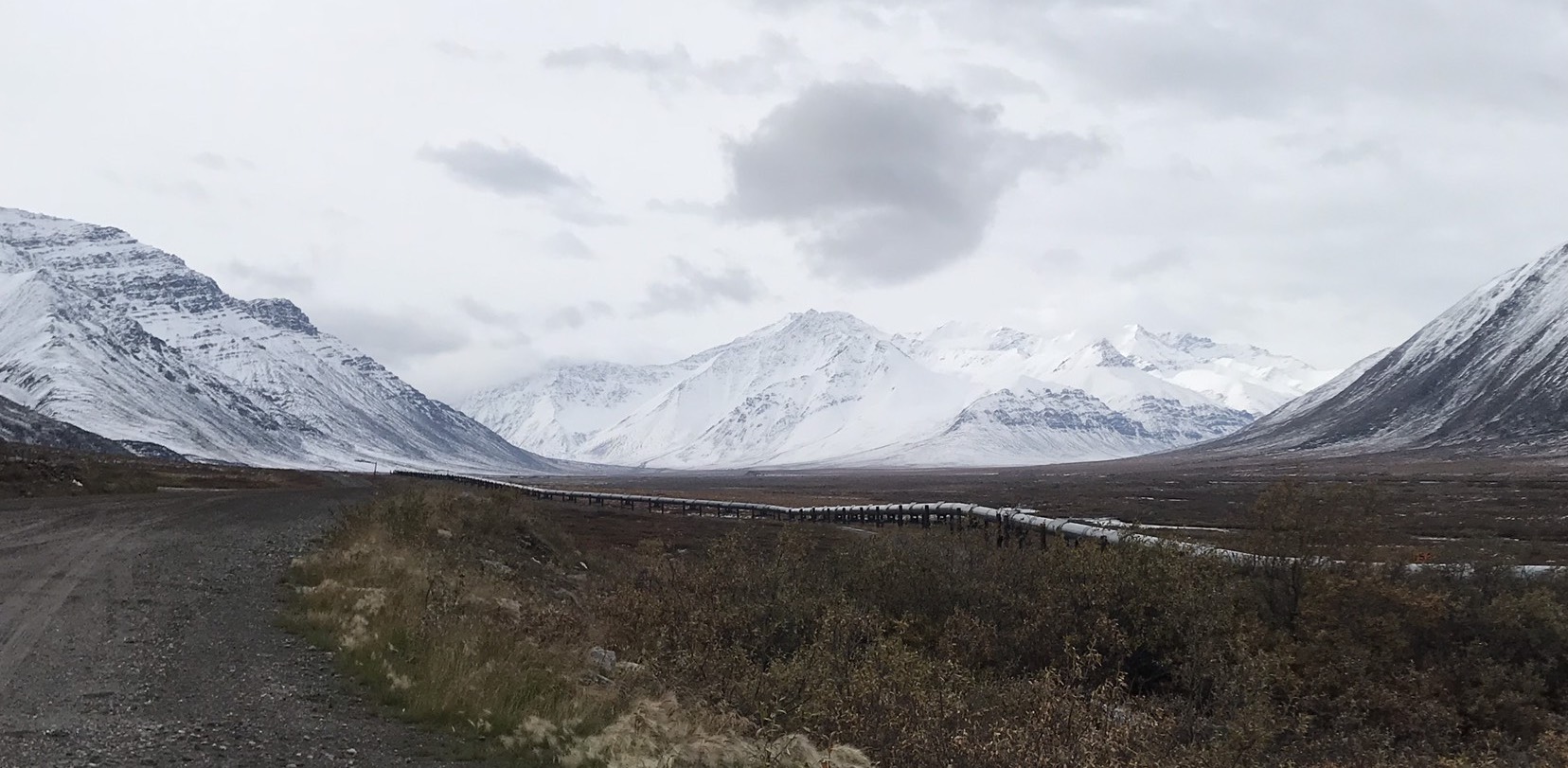
Alaska, British Columbia, and the Yukon are filled with nothing but epic drives and highways. The Dalton Highway stands out because it is the most remote and possibly the most treacherous highway in the US. This is largely due to the fact that the entire 500 or so mile drive is only 25% paved, has no cell service, and only has 2 stops with gas/services, and those stops are 250 miles apart (in Coldfoot, and Prudhoe Bay). If you can stomach the remoteness and potholes, the epic views are well worth any driving risk (in my opinion). Some of the most amazing views we saw were while driving through the Brooks Range over Atigun Pass, the highest mountain pass in Alaska (we happened to drive through the Brooks during a freak August snowstorm). You get to see the transition from tree line to Arctic tundra on the drive, and take photos by the sign announcing when you’ve crossed the 66 degree north latitude line, better known as the Arctic Circle.
Preparedness for Dalton Highway – I didn’t feel that the Dalton was quite as treacherous as it was made out to be. That said, you absolutely need a spare tire (or two), and a spare can of gas. The road is 75% gravel; 25% paved, but the dirt / gravel is hard and pretty nice to drive on. We were able to go 60 mph most of the time, so the trips took less time that Google and Milepost estimated. If anything does go wrong, there are a bunch of truckers on the highway, along with some tourists, so you most likely can flag someone down to help you, if needed. You also should bring your own food and water to last you however long you’re staying in the Arctic.
Cell Service on Dalton Highway – None outside of Fairbanks.
Gas & Other Services on Dalton Highway – You can get gas, a basic meal, some snacks, possibly some beer, and a place to stay in Coldfoot. The only other stop with services is Prudhoe Bay, which is at the end of the Dalton on the Arctic Ocean. We almost went to Prudhoe to check out the Arctic Ocean, but fortunately the weather and a more thorough look at Milepost helped us decide otherwise. Prudhoe Bay is a small oil town. Although we haven’t been there, it seems to be a lot like Coldfoot, except the gorgeous mountain scenery is replaced by oil rigs. You cannot drive out to or see the Arctic Ocean without booking a tour, which seems to be run by the oil company and needs booked 24 hours in advance. There are customs-like border patrols that block you from the ocean unless you’re on the tour bus. My understanding is that the tour of the Arctic is essentially a tour of the oil field, so don’t expect to see lots of icebergs covered in penguins and polar bears. Expect industrial scenery and an explanation of how the pipeline is powered. You can take a ‘polar plunge’ in the Arctic and get a t-shirt (LOL). I’ve taken so many polar plunges in an attempt to get a crude shower, that getting a tourist shirt for one that I took in an oil field seemed to debase the experience.
Pipeline on Dalton Highway – The Dalton follows the Trans-Alaskan Oil pipeline. Milepost has a lot of info on it and tells you where you get especially good views. This wasn’t something we cared about, but, if it’s your thing, then you’ll like this drive even more.
Milepost for Dalton Highway – The Milepost is a great guide to Alaska, but it was more useful than ever for the Dalton. It provides milepost-by-milepost information for the whole highway, and is considered the ‘bible’ of the north. Since you won’t have service or anyone to ask, I’d suggest picking up a copy before tackling the Dalton.
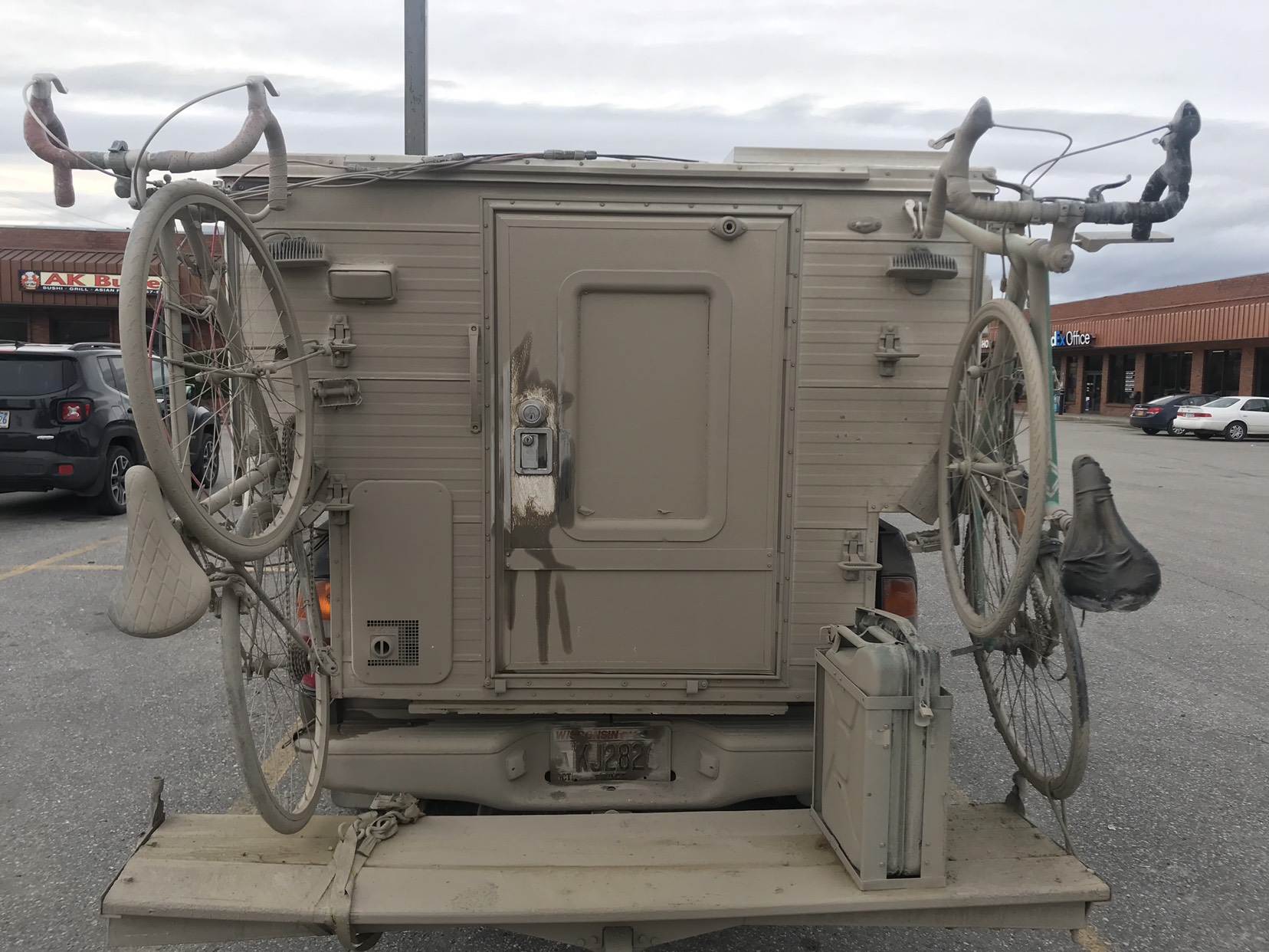
Gettin Down & Dirty on Dalton Highway – This is a random note, but expect your vehicle to be covered in a thick layer of mud (if it’s wet), or dust (if it’s dry). Check out the photo below of our tramper after driving the Dalton.


